|
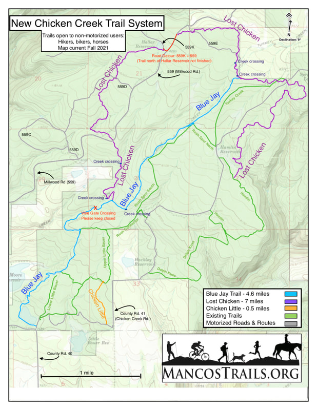
If you're heading out to Chicken Creek to check out the new trails, here's a map you can download (and print if you like!) to help you find your way. It's a bit different from the one at the trailhead because it shows the final trail locations. It also points out gate and creek crossings, and the detour along Roads 559 & 559K to connect the two (not-yet-connected) sections of the Lost Chicken Trail (marked in red). There's more details and trail descriptions on our Trails page - go check it out. Finally, we hope to have the tracks available on our Trailforks maps soon!
1 Comment
|
Archives
July 2024
Categories |

 RSS Feed