Mancos Trails Group
  • Home
  • About
    • MTG Board
    • Supporters
    • Projects
  • News
  • Trails Areas
    • Mancos Spur Trail
    • Chicken Creek Trail System
    • Aqueduct Trail System
    • Transfer Area >
      • Rim Trail
      • Transfer Trail
      • Chicken Creek Trail
      • West Mancos Trail
      • Sharkstooth Trail
      • Gold Run
      • Morrison Trail
      • Aspen Loop
    • Echo Basin >
      • Rampart Hills
      • Box Canyon Trail
      • Coyote Park
      • Owen Basin Trail
      • Red Arrow Road to Hogsback
    • Madden Peak Area Trails
    • Menefee Mountain
    • Mancos State Park
    • E-Bike/Gravel
    • Winter Recreation >
      • Snow Biking
      • Cross Country Skiing
  • Get Involved!
    • Become A Member
    • Donate
    • Events
    • Trail Adoption Program Overview >
      • Aqueduct Trail System Overview >
        • Aqueduct Trail System Segments
        • Aqueduct Trail Adopter Checklist
      • Chicken Creek System Overview >
        • Chicken Creek Trail Segments
        • Chicken Creek Adopters Checklist
      • Mancos Spur Trail Overview >
        • Mancos Spur Trail Segments
        • Mancos Spur Trail Adopters Checklist
    • Trail Maintenance
    • Illegal Land Grab At Chicken Creek
  • Trail Etiquette
  • Store

Box Canyon Trail

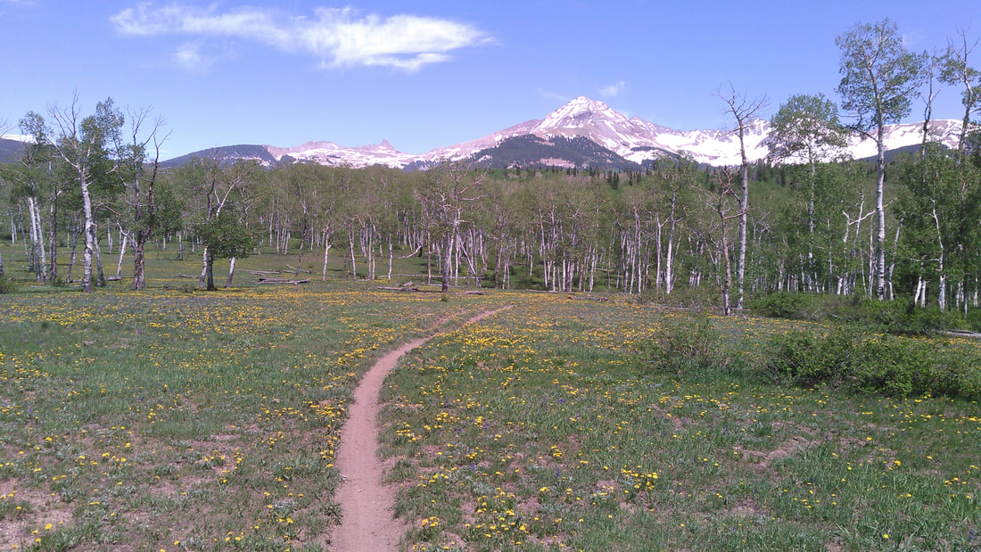
This trail is 6 miles long. It starts along FS561 shortly before you reach Transfer Campground. There is a sign on the right (east) side of the road for the Box Canyon Trail. This is a good place to park. The trail ends near Golconda, as it intersects FS556A. 
This trail can be difficult to follow at times, particularly the section between Gray Beal Spring and Lucy Halls Park.  Take a preloaded GPS route with you as well as a map. You will probably need both. 

Many people do this trail as a loop combined with the West Mancos Trail heading back towards Transfer Campground. This makes for an 11 mile loop. 
This trail can also be accessed by FS331 to eliminate some eroded and steep sections.
Picture
Picture
Box Canyon Trail on Trailforks.com
Picture


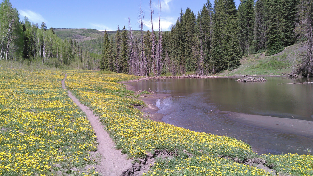
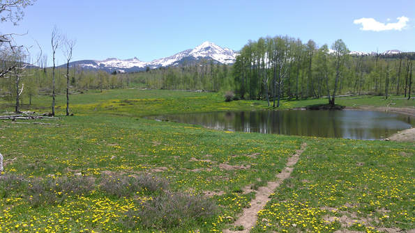
​You will pass a few reservoirs along the way. This is Box Canyon Reservoir.
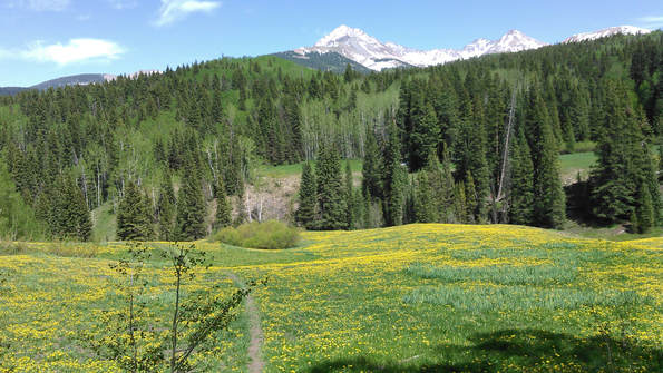
Picture


​Lucy Halls Park

Mancos Trails Group

About us
Become a member
Donate
Contact

    Stay Up To Date and Stay In Touch

Subscribe to Newsletter
Mancos Trails Group
P.O. Box 204
Mancos, CO 81328
© COPYRIGHT 2025. ALL RIGHTS RESERVED.
  • Home
  • About
    • MTG Board
    • Supporters
    • Projects
  • News
  • Trails Areas
    • Mancos Spur Trail
    • Chicken Creek Trail System
    • Aqueduct Trail System
    • Transfer Area >
      • Rim Trail
      • Transfer Trail
      • Chicken Creek Trail
      • West Mancos Trail
      • Sharkstooth Trail
      • Gold Run
      • Morrison Trail
      • Aspen Loop
    • Echo Basin >
      • Rampart Hills
      • Box Canyon Trail
      • Coyote Park
      • Owen Basin Trail
      • Red Arrow Road to Hogsback
    • Madden Peak Area Trails
    • Menefee Mountain
    • Mancos State Park
    • E-Bike/Gravel
    • Winter Recreation >
      • Snow Biking
      • Cross Country Skiing
  • Get Involved!
    • Become A Member
    • Donate
    • Events
    • Trail Adoption Program Overview >
      • Aqueduct Trail System Overview >
        • Aqueduct Trail System Segments
        • Aqueduct Trail Adopter Checklist
      • Chicken Creek System Overview >
        • Chicken Creek Trail Segments
        • Chicken Creek Adopters Checklist
      • Mancos Spur Trail Overview >
        • Mancos Spur Trail Segments
        • Mancos Spur Trail Adopters Checklist
    • Trail Maintenance
    • Illegal Land Grab At Chicken Creek
  • Trail Etiquette
  • Store